|
Note: Local knowledge shows that these estimates generally run low. Typical wind speeds during the daily maximum thermal run 10-16kts.
|
| Date | 1st Tide | 2nd Tide | 3rd Tide | 4th Tide | Sun (Rise/Set) | Moon |
|---|---|---|---|---|---|---|
| Jul 21 |
1:57 am ▲ 2 ft |
6:39 am ▼ 1.7 ft |
2:44 pm ▲ 3 ft |
- | ▲ 6:31:21 AM ▼ 7:43:21 PM |
First Quarter |
| Jul 22 |
12:02 am ▼ 1.4 ft |
4:05 pm ▲ 3 ft |
- | - | ▲ 6:31:44 AM ▼ 7:43:02 PM |
First Quarter |
| Jul 23 |
1:22 am ▼ 1.1 ft |
5:34 pm ▲ 3.1 ft |
- | - | ▲ 6:32:07 AM ▼ 7:42:42 PM |
First Quarter |
| Jul 24 |
1:56 am ▼ 0.7 ft |
9:35 am ▲ 2.4 ft |
12:36 pm ▼ 2.3 ft |
6:35 pm ▲ 3.3 ft |
▲ 6:32:31 AM ▼ 7:42:21 PM |
Waxing Gibbous |
| Jul 25 |
2:22 am ▼ 0.4 ft |
9:28 am ▲ 2.5 ft |
1:24 pm ▼ 2.1 ft |
7:19 pm ▲ 3.5 ft |
▲ 6:32:54 AM ▼ 7:41:59 PM |
Waxing Gibbous |
| Jul 26 |
2:45 am ▼ 0.2 ft |
9:33 am ▲ 2.7 ft |
1:56 pm ▼ 1.9 ft |
7:55 pm ▲ 3.8 ft |
▲ 6:33:17 AM ▼ 7:41:35 PM |
Waxing Gibbous |
| Jul 27 |
3:08 am ▼ 0 ft |
9:44 am ▲ 2.8 ft |
2:25 pm ▼ 1.8 ft |
8:27 pm ▲ 4 ft |
▲ 6:33:40 AM ▼ 7:41:11 PM |
Full |
Puerto Vallarta / Lic, Mexico (MMPR) 20-41N 105-15W
Jul 21, 2026 - 04:47 PM EDT / 2026.07.21 2047 UTC
| Wind | from the SW (220 degrees) at 9 MPH (8 KT) |
| Visibility | 12 mile(s) |
| Sky conditions | mostly clear |
| Temperature | 93 F (34 C) |
| Heat index | 106.7 F (41.5 C):1 |
| Dew Point | 77 F (25 C) |
| Relative Humidity | 59% |
| Pressure (altimeter) | 29.83 in. Hg (1010 hPa) |
| Pressure tendency | 0.01 inches (0.2 hPa) lower than three hours ago |
| ob | MMPR 212047Z 22008KT 12SM FEW030 34/25 A2983 RMK SLP094 57002 978 8/100 ISOL CS/SW |
| cycle | 21 |
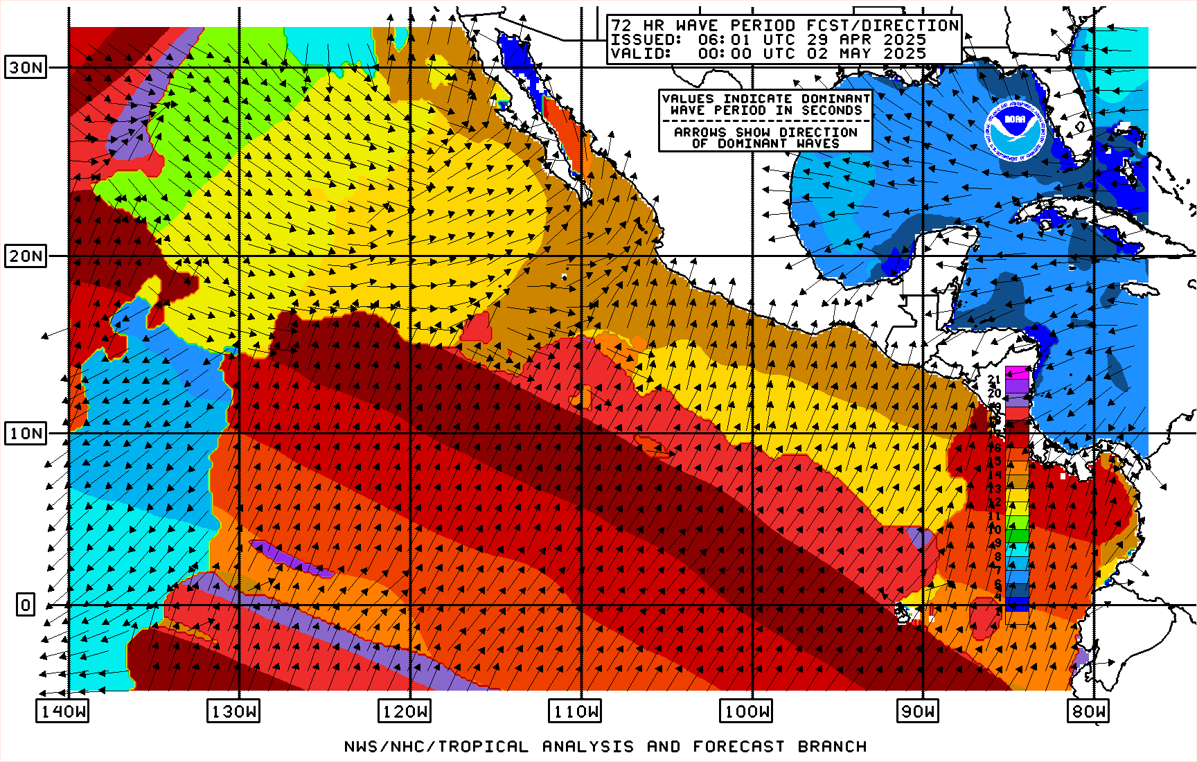
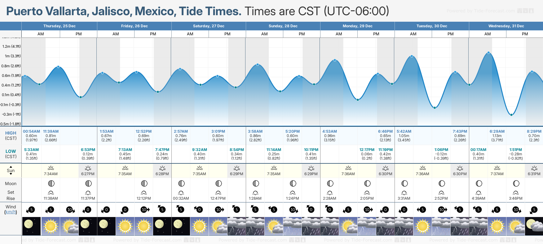

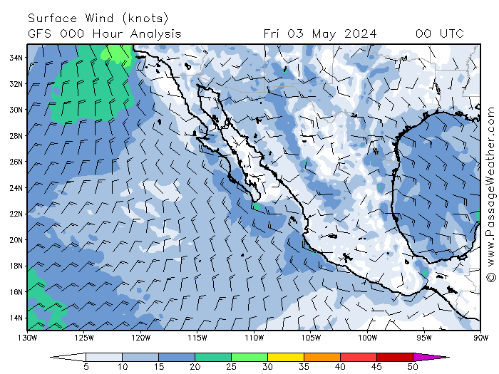
Information here is copyright passageweather.com. Click the image for more weather forecasts.
- NOAA: Tropical Weather Discussion - Eastern North Pacific
- NOAA: Tropical Weather Discussion - Eastern Pacific
- NOAA: Offshore Waters Forecast - East Pacific
- NOAA: Tropical Weather Outlook
- NOAA: Tropical Weather Alerts
- NOAA: Marine Graphical Composite Forecast Map for Mexico Pacific Offshore Waters
- SEMAR: Carta Sinoptica
- NOAA: Satellite Imagery - Geocolor, Visible, IR, Water Vapor
- NOAA: 24 Hour Wind/Wave Forecast
- NOAA: Eastern Pacific Surface Analysis